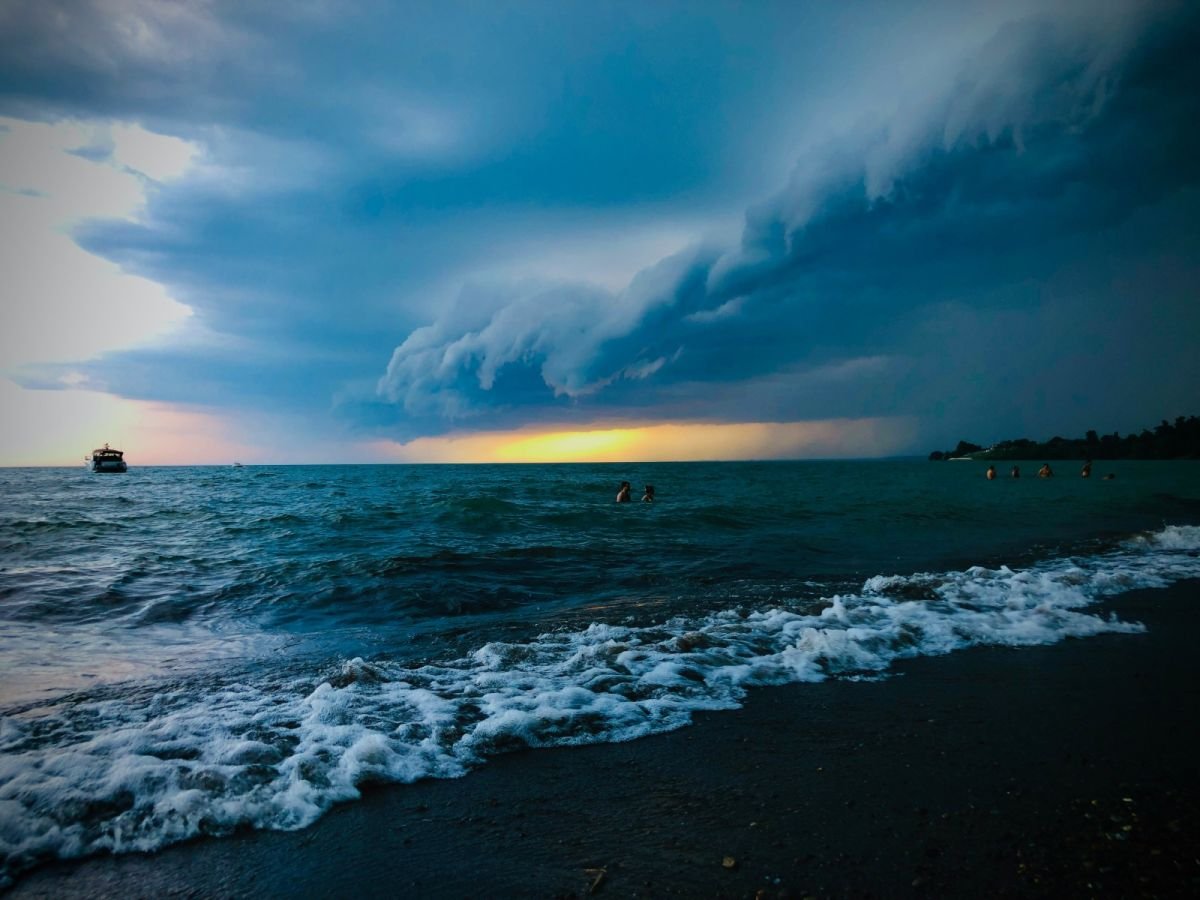
Practical onboard weather analytics
Onboard weather analytics—or practical synoptic observation—consists of continuously matching pressure changes with the physical transformations taking place in the atmosphere and biosphere. A complete picture of the situation is built through attentive observation of the sky and water surface, as well as an understanding of local anomalies. This is critical both on the open sea and when navigating dense archipelagos or coastal zones.
1. Clouds and their dynamics
The presence of clouds themselves is less important than their succession (sequence) and the speed of their vertical development.
Flat Cumulus (Cumulus humilis): Small, with a clearly defined base, appearing in the morning and dissipating by evening. These are classic fair-weather clouds signaling a stable air mass.
Vertical growth (Cumulus congestus / Cumulonimbus): When cumulus clouds start "swelling" upward before noon, with tops resembling cauliflower, strong convection is at play. The expansion of the top into an anvil shape (Incus) indicates a mature thunderstorm cloud (Cumulonimbus). It brings squalls, heavy downpours, lightning, and a sudden wind shift of 90 degrees to 180 degrees
Mares' tails (Cirrus): Long, delicate, icy streaks resembling hair or commas. If they appear in a clear sky and gradually thicken into a uniform Cirrostratus sheet (creating a halo around the sun or moon), they signal an approaching warm front within the next 12–24 hours.
"Mackerel Sky" and lenses (Altocumulus lenticularis or castellanus): High clouds arranged as smooth lenses or small towers. They signal instability in the mid-atmosphere and strong winds aloft, often forecasting a weather deterioration, an approaching front, or strong surface winds within a few hours.
2. Sky color and optical phenomena
The color of the sky near the horizon stems from the way sunlight passes through air layers of varying humidity and dust levels.
Red sunrise: Clear air to the east, but light illuminates clouds and high humidity advancing from the west. Signal of deteriorating weather and possible rain during the day.
Red sunset: Light passes through dry air and a clear atmosphere to the west. A sign that good weather will persist into the next day.
Bright yellow or greenish-blue sky at dawn/dusk: High moisture content in the air, forecasting wind and rain.
Dull, pale sky during the day: A sign of rising humidity and a drop in air mass stability.
3. Visibility and fog
Surface visibility over water is tightly linked to air mass characteristics and the dew point.
Exceptionally high visibility (crystal-clear air): Occurs after a cold front passes within a fresh polar air mass. Foretells strong, gusty winds alongside excellent air clarity.
Rapid drop in visibility under high pressure: Results from water droplets suspended in the air (mist/haze). Changes in water temperature or air sinking in the evening often lead to fog formation.
Advection (sea) fog: Forms when warm, moist air flows over colder water (typical in spring on the Baltic). It can persist for days regardless of the time of day or wind strength.
Radiation (coastal/inland) fog: Forms at night during frost-free, clear weather due to land cooling. It typically clears 2–3 hours after sunrise as solar heating kicks in.
4. Barometer: measurements and tendency
Crucial for the skipper is the barometric tendency (the change over 3 hours), not the pressure value itself.
Pressure tendency | 3h Change | Expected conditions |
Slow rise | +1 to +2 hPa | Settling weather improvement, decreasing wind. |
Rapid rise | > 3 hPa | Short-lived improvement, often followed by strong northerly winds. |
Slow fall | -1 to -2 hPa | Approaching warm front, deterioration in 12–24h (rain, moderate wind). |
Fast fall | -3 to -5 hPa | Proximity to a deep low or cold front. Strong winds within hours. |
Plunging fall | > 5 hPa | Storm, severe gales, or a passing squall line. |
5. Reading the water surface
Sea state often precedes what happens in the air above it.
Squall harbingers ("Cat's Paws"): Darker, rippling patches on the water moving toward the yacht are a visual sign of an incoming wind hit.
Swell vs. wind direction: If the yacht begins to feel a swell coming from a direction different from the current wind, it signals a deep low operating beyond the horizon.
Changing wave characteristics: A short, steep, and nervous wave breaking under light wind foretells a sudden rise in wind force within minutes.
Surface smoothing in rain: Heavy, large-drop rain can mechanically "flatten" the waves, making the sea appear unnaturally flat for a moment. This frequently accompanies the passage of a squall line.
6. Coastal and orograhic phenomena
Coastal topography drastically modifies air mass flow.
Funnelling effect: Wind forced into narrow straits becomes compressed. Wind speed increases by 1 to 2 Beaufort force levels compared to open water, and its direction shifts along the axis of the channel.
Katabatic winds (downslope wind): Cold air "draining" down steep hillsides at night can generate sudden downward blasts (fall winds/katabatic squalls), which are hazardous in high-cliff anchorages.
Coastal barrier: Approaching a high coastline from the windward side often causes the wind to weaken a few miles off the coast, while the sea grows chaotic due to rebounding air masses.
7. Biosphere signals and temperature perception
Living organisms and human senses react to atmospheric physics extraordinarily early.
Bird behavior: Gulls soaring high indicate stable air. Birds gathering on the shore or flying just above the water surface signal that dropping pressure is making flight difficult—foretelling wind gusts and rain.
Temperature perception on watch:
Cold draft before a storm: A downdraft from a Cumulonimbus cloud means a wind strike is a matter of minutes away.
Sudden heat and moisture hit: "Sticky" air at night means crossing a warm front line. This is the moment to expect a drop in visibility.
Vegetation: An intense smell of reeds, grass, or forest reaching the deck from land indicates a drop in pressure and the release of ground gases driven by rising humidity.
Sources of synoptic knowledge in this guide:
This synthesis is based on proven maritime and meteorological literature, as well as observational standards:
World Meteorological Organization (WMO) – International Cloud Atlas (classification, physics, and cloud evolution).
Jacek Czajewski – Sailing Meteorology (fundamentals of analyzing phenomena on marine waters, the significance of barometric tendency, fog formation).
Alan Watts – The Weather Handbook (rapid sky analysis, reading water signs before squalls arrive).
ISSA / RYA Training Materials – Guidelines for meteorological navigation in coastal and offshore sailing.
